The drive from Cayuse Pass (via Highway 123) to Packwood (US 12) is one of our favorite scenic drives en route to trailheads in the southern Cascades. We’ve been exploring points of interest along the White Pass Scenic Byway; our first stop at the junction with US 12 was to check out the popular La Wis Wis Campground. During mid-May, the road to the campground was still closed though will open near Memorial Day weekend – you can walk into the campground year-round as it’s only about a mile from US 12.
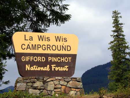
La Wis Wis Campground
La Wis Wis Campground
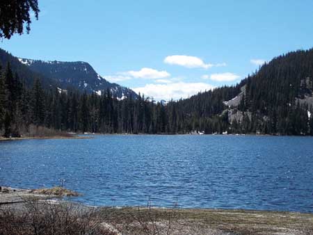
La Wis Wis is the Native American term that translates to place of “swirling waters.” The Native American word (Taidnapam or Upper Cowlitz tribes) for Ohanapecosh translates to “standing at the edge.” The Ohanapecosh River is the main headwater tributary of the Cowlitz River that begins at the confluence of the Ohanapecosh River and the Clear Fork Cowlitz River – you can see the confluence from the campground.
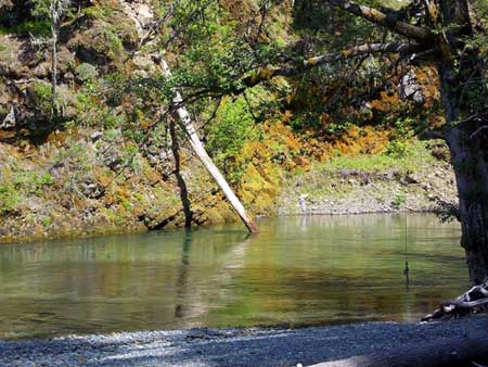
The Blue Holes – La Wis Wis Campground
The walk on the road to the campground was gentle and pretty where vanilla leaf has leafed out along the road with its sweet scent (no wonder pioneer women stuffed their dresser drawers with it). We soon came upon a sign for “Blue Hole – ½ mile” which we wanted to see, a short, popular trail that leads to the river.
We crossed the Clear Creek on a road-bridge and entered the campground and set out to explore. We never did find a trail sign in place for the Blue Hole though common sense indicated we simply needed to head toward the river. As we walked the deserted campground loop we spotted a direct path to the river. Here we looked down on what appeared to be a deep pool with a fraying rope-swing hanging from a tree-branch. Nearby was also a posted notice indicating that water play or swimming there was prohibited due to dangerous conditions and lack of security. Whether or not that closure remains in place year-round is not known; check with the Cowlitz Ranger District or campground hosts; always respect such signs (they are there for good reasons). In fact if you venture off the trail be careful any time of the year as the banks above the swiftly-flowing rivers are subject to erosion and the rivers are cold.
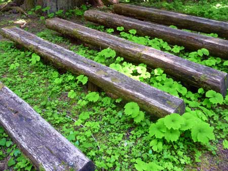
Only the vanilla leaf listens
As we walked through the campground we agreed that Site No. 7 was the ideal site, not too close to other sites and located right above the river with a short boot-path to a large gravel bar beside the river. It’s a very pretty site; one couldn’t find one better.
Continuing our walk we came to an amphitheater that is not yet in use; vanilla leaf was growing between the benches where fireside chats may take place later in the season. Nearby was a picnic shelter that had the “CCC” look about it; a strong structure built to last. We also passed interpretive displays; one about the nearby discovery of Taxol that is used to treat breast cancer and another to honor President Taft who played a pivotal role in establishing the Gifford-Pinchot National Forest in 1908.
Packwood to White Pass
By the time we walked back to the car we’d walked about 3.5 miles round-trip (per our GPS); more than we’d imagined, almost enough to justify our stop at the Butter Butte Coffee house in Packwood for strong coffee and a sweet treat before we continued our drive. The Mountain Goat Coffee Company did not disappoint and we were soon on our way to White Pass.
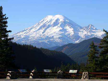
Mt Rainier Viewpoint
Allow plenty of time between Packwood and White Pass as there are several points of interest including the viewpoint at The Palisades, a must-see whether you are coming or going from White Pass. Not only are there striking views of Mount Rainier you can view dacite columns that rise from the canyon of the Clear Creek Cowlitz River. Though estimates of this time-weathered feature vary these columns were formed some 20,000 to 110,000 years ago by volcanic processes. This unusual landform is an astounding display that even a poet would find hard pressed to put into words. We also stopped at the next overlook with its handsome sign designating the White Pass Scenic Byway with views of Mount Rainier and the snowy Goat Rocks.
We continued to White Pass where we found few people and only a couple small patches of snow under the stilled ski lifts. White Pass felt like it was holding its breath, waiting for summer to arrive and we met an employee who said they were shutting down for the summer.
Leech Lake
From White Pass we continued east another quarter mile or so and turned left onto Forest
Leach Lake near White Pass
Road No. 498 to the Pacific Crest Trail trailhead and the Leech Lake Boat Launch and Campground. Incidentally there are about three different names for this pretty lake – Leech Lake, White Pass Lake and at the campground it is designated Leech Lake (resources vary). From the trailhead you can hike the short and justifiably popular trail to Sand Lake which is also used by skiers and snowshoers in winter.
We had the lake to ourselves in the warm sun; my companion stretched out on a picnic table to soak up the warm sunshine while I poked around the lakeshore admiring the scenery. All too soon it was time to retrace our route back to Highway 123 and wend our way westward though we couldn’t resist driving to Chinook Pass to see if Tipsoo Lake was beginning to thaw (it was) though the snow was still piled high along SR 410.
By Karen Sykes for the White Pass Scenic Byway