Explore the east end of the White Pass Scenic Byway and discover the dramatic and rugged beauty of this wilderness area. Spend time touring spectacular Mount Rainier National Park. Witness unique geologic formations and awe-inspiring views on the Chinook Scenic Byway. See alpine lakes, watch elk herds in the hundreds and view historic dams.
The route is usually snow-free by the end of May and remains open through October. The road closes each year due to winter snowfall from November to May.
From the intersection of US Highway 12 and State Route (SR) 123 Cayuse Pass, travel north on SR 123 for 16.3 miles to SR 410.
Turn right on SR 410 and travel 50.5 miles to US Highway 12.
Turn right on US Highway 12 and travel 46.7 miles back to the intersection of US Highway 12 and SR 123
Start: This journey begins at the intersection of US Highway 12 and SR 123, about seven miles east of Packwood.
Stop 1: Ohanapecosh Visitor Center – First along this journey, at an elevation of 1,914 feet, stop at Ohanapecosh. Situated among Douglas firs, western red cedars, and western hemlocks, visitors can experience the beauty and complexity of an old-growth forest. This lush area offers a visitor center featuring exhibits about local history, wildlife, and the old-growth forests found in this southeast corner of the park. Speak with a park ranger and learn more about the fascinating geology of the area. See the remains of the historic hot springs in the boggy area near the visitor center. Guided interpretive programs, maps, restrooms, and book sales are available. Also, find the very popular Ohanapecosh Campground. A well-designed camping area; sites are sorted into smaller loops to keep visitors from feeling overcrowded. The Ohanapecosh River roars through the campground, separating the two major camping areas.
Side Trip: Stevens Canyon Entrance & Grove of the Patriarchs – Turning left onto Stevens Canyon Road, travel through the Stevens Canyon Entrance to Mt. Rainier National Park. Wander among the towering giants and witness trees thousands of years old. Just before the bridge crossing the Ohanapecosh River, turn left into a parking area for the trailhead to Grove of the Patriarchs. Everyone in the family will enjoy this easy 1.5-mile loop through spectacular old-growth forests. Witness ancient stands of gigantic Douglas-firs, western hemlock, and western red cedar, some estimated to be over 1,000 years old. People come from all over the world to experience walking through ancient forests of trees with 30-foot circumferences.
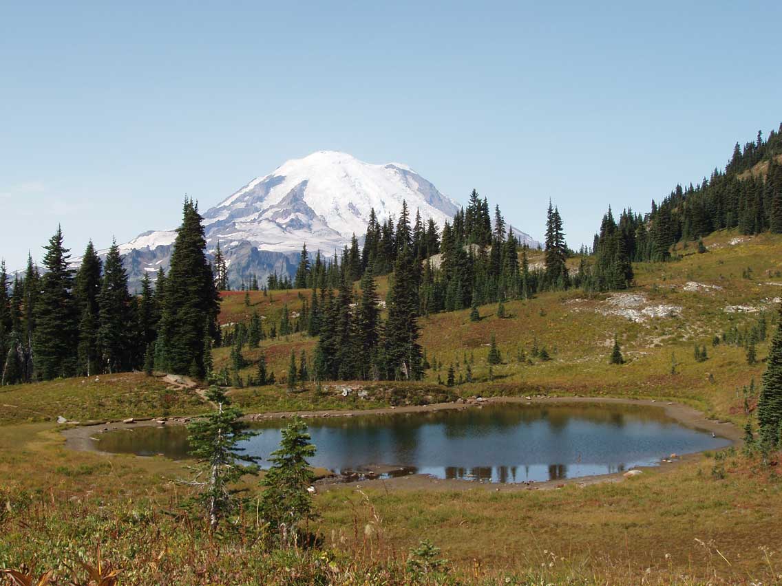
Stop 2: Chinook Pass Summit and Tipsoo Lake – Traveling about five miles along the Chinook Scenic Byway, drive under the dramatic log and stone archway marking the summit of Chinook Pass. This archway also serves as a pedestrian bridge for hikers on the Pacific Crest Trail. This roadway is also named the Mather Memorial Parkway, honoring Stephen Mather, the first director of the National Park Service. It is just a few hundred meters from the summit, and it stops at stunning Tipsoo Lake. A breathtaking sight to behold, this little alpine gem is one of the most photographed landscapes in the country. Hike the short nature trail around the lake and witness the outstanding views of Mt. Rainier and the Cascade Mountains. A picnic area is also located here.
Stop 3: Pleasant Valley Interpretive Trail – Enjoy a stop at this day-use area, offering a walk along the Pleasant Valley Interpretive Trail. This one-mile accessible trail winds through old-growth forest. Find the trail at the Pleasant Valley Campground.
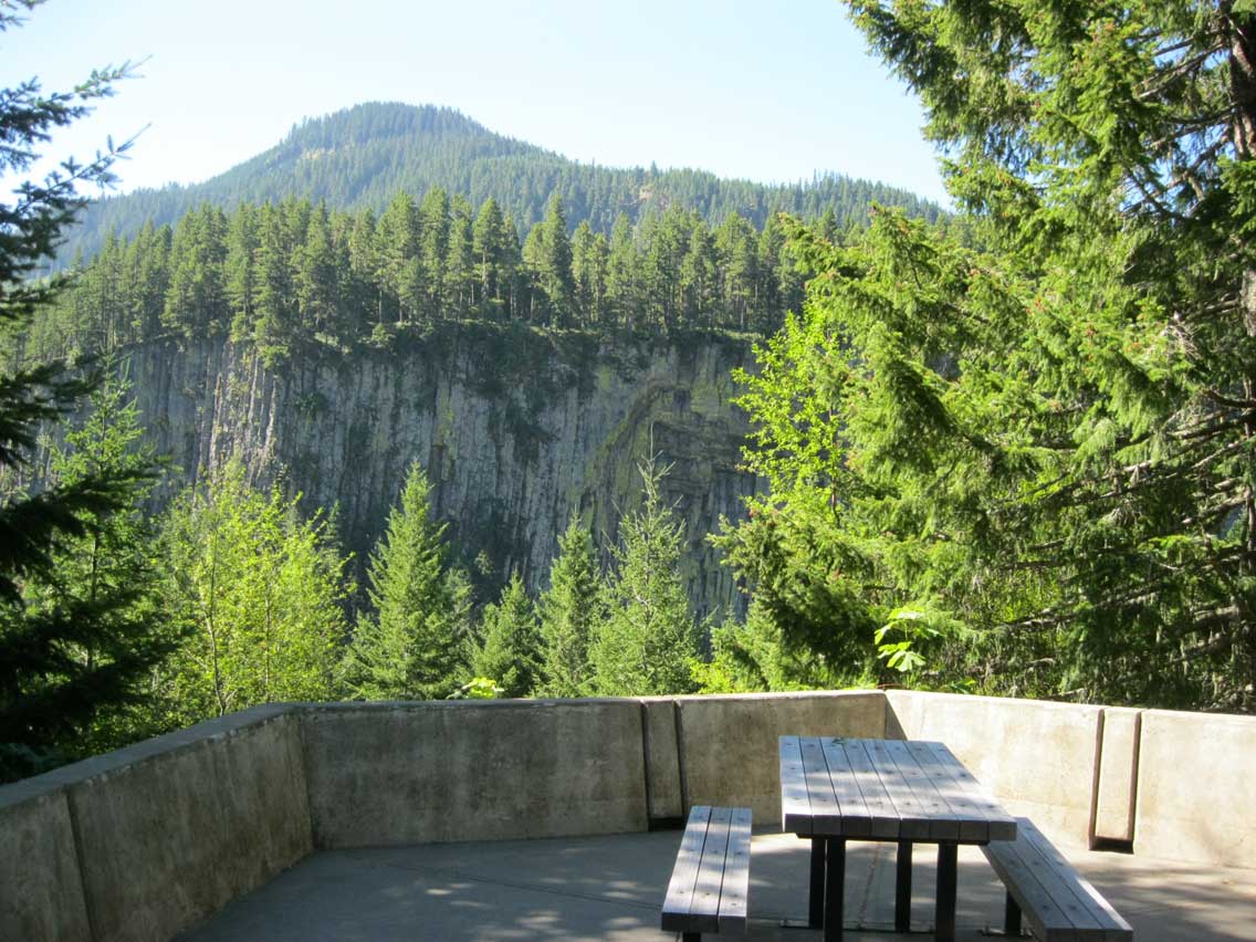
Stop 4: Fife’s Peak Viewpoint – Stop here for a great view of this rocky peak rising above the thick forest canopy below. Named after a 19th-century homesteader, this peak at 6,917 feet elevation is a great example of the rugged geologic features of the eastern Cascade Mountains.
Side Trip: Bumping Lake and Goose Prairie – Turn right onto Forest Road 1800, travel through Goose Prairie, and arrive at Bumping Lake, 11 miles away. Camping, fishing, boating, and hiking opportunities abound in this popular outdoor recreation destination. Six campgrounds are located along the way as well as a boat launch and day-use picnic area at Bumping Lake. It was in this area that Chief Justice William O. Douglas owned a home. He spent much of his time enjoying this wilderness area, which was later named for him.
Stop 5: Sawmill Flat Interpretive Trail – For a nice walk through the open Ponderosa pine forest, tour the quarter-mile accessible Sawmill Flat Interpretive Trail. A great walk for the whole family.
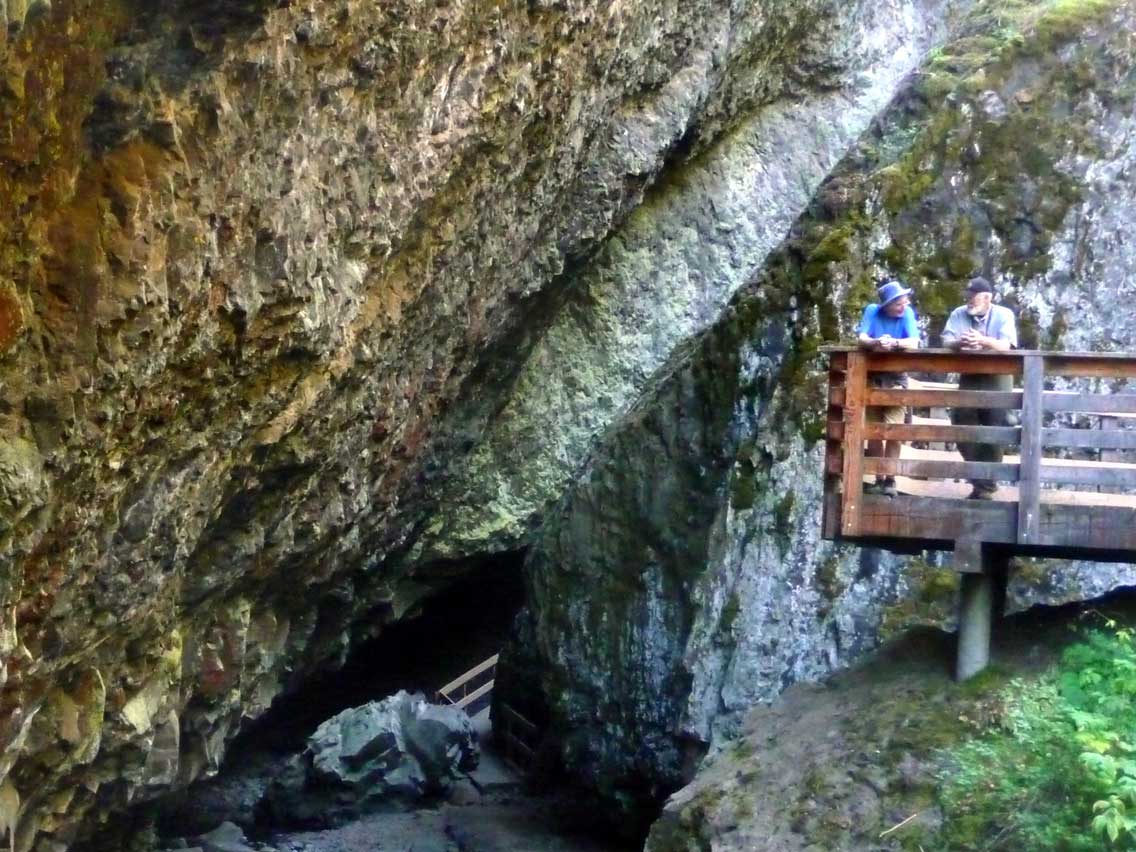
Stop 6: Boulder Cave & Nature Trail – Turning right off SR 410, travel a short way down Forest Service Road 1706 to Boulder Cave. An easy, family-friendly, gravel two-mile round-trip trail leads along a ravine, climbing through magnificent forests arriving at the cave, a natural stone tunnel. At nearly 200 feet long, bring a jacket and a flashlight. This fascinating tunnel is both cool and dark. Listen to your voice echo. Feel the cool moisture in the air. This walk is a treat for all the senses. A picnic area is located at the trailhead. Boulder Cave is open daily from April 1st through October 31st. It closes each winter when a small population of Pacific Western Big-Eared Bats inhabits the cave. This is the only known population of these bats in this area of Washington State. Due to heavy human use, the bats are only present in the winter months during the closure.
Stop 7: Cliffdell – Nestled in the Wenatchee National Forest along the beautiful Naches River, visit Cliffdell, a quiet recreation area. In this picturesque community, vacation homes are nestled in the tall pines and along the rock-strewn ridges. Businesses and services are located here.
Stop 8: Edgar Rock – Stop at this viewpoint to admire the monolith of a great jagged rock called Edgar Rock. An area with a fascinating history, it’s named for a well-known pioneer, trader, and scout, John Edgar, who guided wagon trains across the Cascades. Much later, from 1933 through 1951, a lookout stood on its summit. A four-mile round-trip trail climbs up and over the rock, a route John Edgar used to trade with Indians. Walking along the trail today, view bluebird boxes, wildflowers, and interesting rock formations.
Notice: Chinook Pass Work Center – See the two granite columns marking the eastern end of the Mather Memorial Parkway. This area was also used as a ranger station from 1906 to 1981. The Chinook Scenic Byway continues past this point to the town of Naches.
Stop 9: Lava Flows – Stop here to view the significant amount of volcanic rock on the left side of the highway. Displaying the volcanic history of the area, this is one of many impressive geologic features dominating the eastern side of the Chinook Scenic Byway.
Stop 10: Oak Creek Wildlife Area – Bighorn Sheep Feeding Station – Turn left off SR 410 onto the Old Naches Highway and travel less than a mile to a primitive parking area for the Oak Creek Bighorn Sheep Feeding Station. See an impressive view of the magnificent bighorn sheep. They can be seen throughout the year at this small feeding station set at the base of a dramatic cliff on Mount Clemans.
Stop 11: Oak Creek Wildlife Area – Elk Feeding Station – This is one of the best locations for watching elk feeding in the entire United States. Oak Creek is truly a sight to behold. In winter, elk congregate at the Oak Creek feeding station in herds by the hundreds. See the elk up close as they jostle for position at the hay drop stations. Other wildlife viewing includes bighorn sheep, woodpeckers, raptors, and a variety of songbirds.
Stop 12: Tieton Dam Heritage Marker – A popular roadside view, see Tieton Dam, built in 1901, forming Rimrock Lake, a popular place for water play.
Stop 13: Rimrock Dam and Lake – The highest elevation large lake along the White Pass Scenic Byway, see Rimrock Lake offering recreation, camping, and fantastic views of the surrounding foothills. Anglers enjoy time spent fishing for rainbow trout and kokanee.
Stop 14: Clear Lake and Falls – Located right next to Rimrock Lake, smaller Clear Lake is another popular fishing destination and is also a good watchable wildlife location. Like Rimrock, Clear Lake is a good place to view bald eagles, osprey, and elk.
Stop 15: Dog Lake – Sitting at 3,400 feet elevation, view Dog Lake offering an abundance of outdoor recreation. From camping and wilderness hiking to boating and fishing for native rainbow trout, this area is ready for the outdoor enthusiast.
Stop 16: White Pass Ski Area – A major winter ski destination, White Pass Ski Area also offers some hiking in the summer and a pleasant stop along the roadway in a high mountain environment. The driest powder in the Washington Cascades, White Pass has a 6,000-foot summit and a 1,500-foot vertical drop. It averages over 300 inches of snow each year.
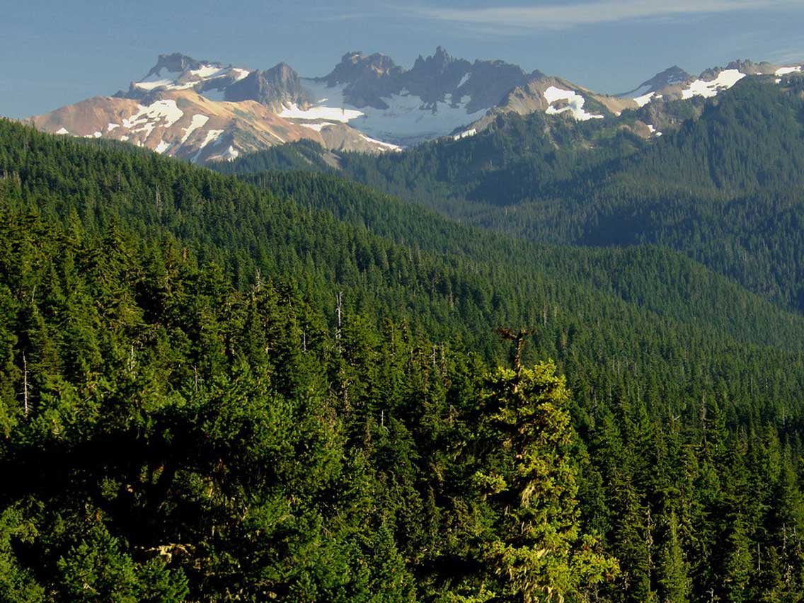
Stop 17: Goat Rocks Viewpoint – What a view! This stop offers magnificent views of Mt. Rainier and the Goat Rocks. Named after the goats inhabiting the area, the Goat Rocks are part of an ancient volcano that once stood over 12,000 feet high. After thousands of years of erosion, today, the range’s highest point is slightly over 8,000 feet.
Stop 18: Palisades Viewpoint – This newly-renovated safety rest area and viewpoint offers views of dramatic volcanic palisades rock formations, forming the backdrop of a steep valley. It is a unique sight to see — and one that should not be missed.
End: The route comes to an end as it returns to the intersection of SR 123 and US Highway 12, just west of the Town of Naches. Roads in this itinerary can be windy, and many have steep drop-offs on either side. Always drive with caution and expect wildlife. Please check local ranger stations for winter road closures.
Questions or Comments? Drop us a note we’d love to hear from you.